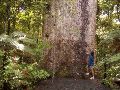
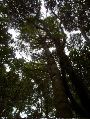
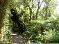
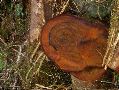
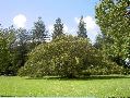
Tane Mahuta kauri, the world's second tallest type of tree
The name of this particular kauri
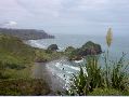
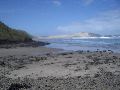
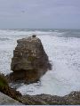
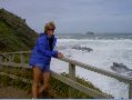
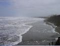
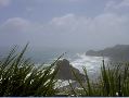
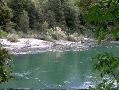
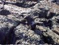
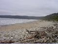
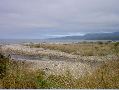
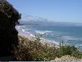
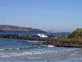
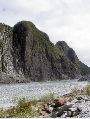
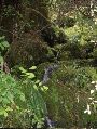
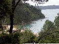
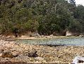
Kare Kare Beach, west of Auckland
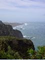
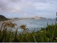
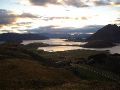
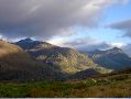
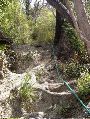
Above Kare Kare Beach west of Auckland, looking toward Whatipu and Manikau harbor inlet

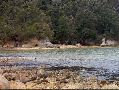
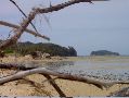
Kare Kare Beach west of Auckland
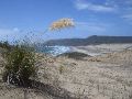
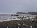
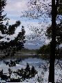
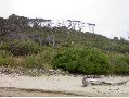
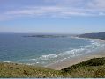
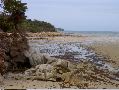
Bethels Beach northwest of Auckland
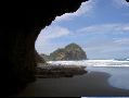
Bethels Beach
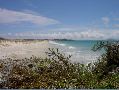
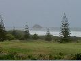
Keri Keri Penninsula near North Cape
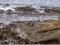
Keri Keri Penninsula
Cape Reinga, farthest north on North Island
Cape Reinga
Cape Reinga
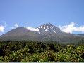
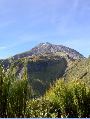
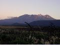
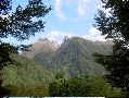
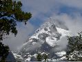
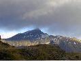
Taranaki (Egmont), West Coast, North Island
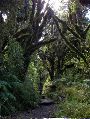
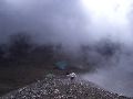
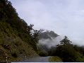
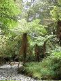
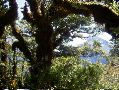
Goblin Forest, beginning of circuit track around Taranaki
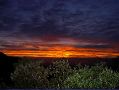
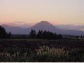
Sunrise on Taranaki circuit track
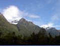
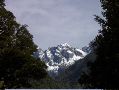
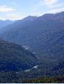
Taranaki track view to the top 1
Taranaki track view to the top 2
Taranaki track view to the top 3
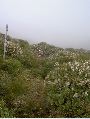
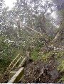
Taranaki overgrown track
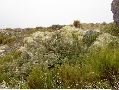
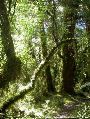
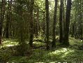
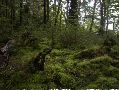
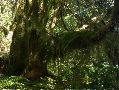
Taranaki bush
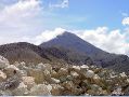
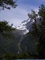
Ngarauhoe ('Lord of the Rings' Mount Doom), Tongariro National Park
Ruapehu (North Island's tallest mountain), Tongariro National Park
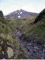
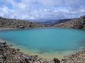
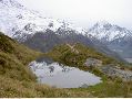
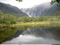
Upper Tama Lake, Tongariro National Park
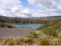
Lower Tama Lake, Tongariro National Park
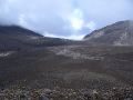
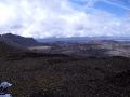
Sand Crater, The Crossing, Tongariro National Park
Sulfer pools, The Crossing, Tongariro National Park
Sulfer pool, The Crossing, Tongariro National Park
Red Crater, Tongariro National Park
Mount Doom
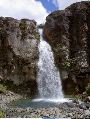
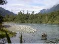
Taranaki Falls, Tongariro National Park
Below Taranaki Falls
Te Aroha summit track, southeast of Auckland
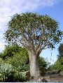
Giant aloe, Botanical Gardens, Auckland
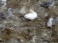
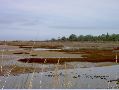
Gannet colony, Muriwai, northwest of Auckland
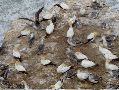
Gannet colony
Gannet colony
Muriwai
Muriwai
Muriwai
Muriwai
Small kauri in Goldie's Bush near Muriwai
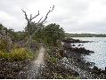
Piha between Kare Kare and Bethels
Rangitoto Island in Auckland Harbor
Rangitoto plantlife
Rangitoto volcanic shoreline
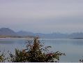
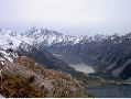
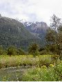
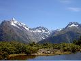
Lake Tekapo near Mount Cook, South Island
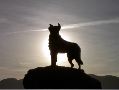
Tekapo monument to the shepard dog
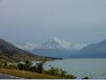
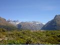
Tekapo looking at the range near Mount Cook
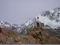
Glacier view from Mount Cook Village
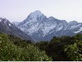
Mount Cook
Mount Cook Village and Hooker Valley
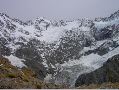
Glaciers near Mount Cook Village
Glaciers near Mount Cook Village
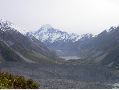
Mount Cook and Hooker Valley
Outlet of Hooker Valley
Mount Cook beyond reflecting pool
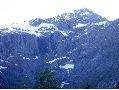
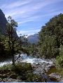
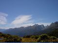
View towards Milford Sound from Divide
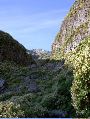
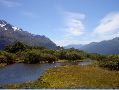
View from Hollyford Valley
View from Hollyford Valley
View from Hollyford Valley
View from Hollyford Valley
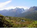
Hollyford Valley track
View from Hollyford Valley
View from Hollyford Valley
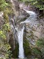
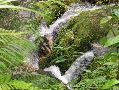
Hidden Falls in Hollyford Valley
Hollyford Valley track
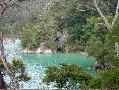
Alabaster Lake in Hollyford Valley
View from Hollyford Valley
Hollyford Valley track
View from Hollyford Valley
Red beech in Hollyford Valley
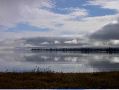
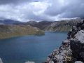
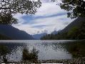
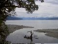
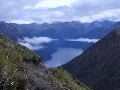
Lake Te Anau from Kepler track
Kepler track
Kepler track
Kepler track damage
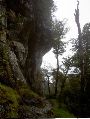
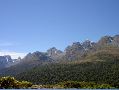
Kepler track limestone bluffs
Lake Te Anau from Kepler track
Lake Te Anau from Kepler track
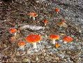
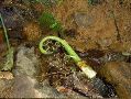
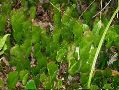
Mushrooms on Kepler track
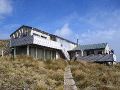
Kepler track hut in tussock grass above limestone bluffs
Kepler track
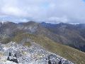
Fiord view from Kepler track
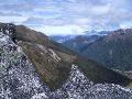
Kepler track
Kepler track
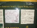
Data on the Kepler track
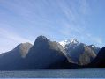
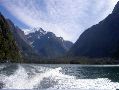
Towards Milford Sound
Towards Milford Sound
Towards Milford Sound
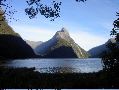
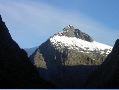
Mitre Peak, Milford Sound
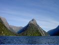
Mitre Peak
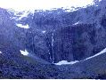
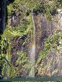
Glacier and cataract, Milford Sound
Tree slide, Milford Sound
Cataract, Milford Sound
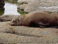
Seal, Milford Sound
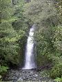
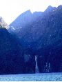
Falls, Milford Sound
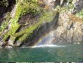
Falls, Milford Sound
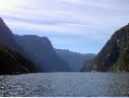
Milford Sound
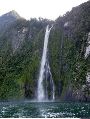
Falls, Milford Sound
Milford Sound
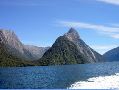
Mitre Peak
Leaving Milford Sound
Towards Hollyford Valley and the Routeburn track
Key Summit, Routeburn track, beginning of 360 turn
Key Summit, Routeburn track, second in 360 turn
Key Summit, Routeburn track, third in 360 turn
Key Summit, Routeburn track, fourth in 360 turn
Key Summit, Routeburn track, fifth in 360 turn
View of Routeburn track from Key Summit
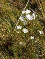
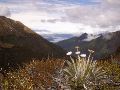
White gentian, Key Summit
Key Summit
View of Hollyford Valley from Key Summit
Key Summit
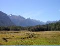
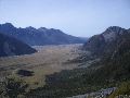
Mossburn Valley towards Key Summit
Humpridge track, south coast of South Island
Humpridge track
Humpridge track
Humpridge track
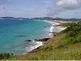
Curio Bay, Scenic Drive, south coast
Tautuku Bay, Scenic Drive
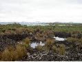
Shag Point, southeast coast, South Island
Shag Point
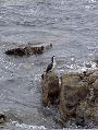
Shag Point namesake
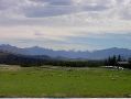
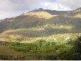
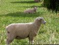
Typical New Zealand farmland, near Lake Wanaka, middle of South Island
Sunrise over a private track near Lake Wanaka
View from the private track near Lake Wanaka
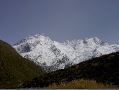
Mount Aspiring, middle of South Island
Mount Aspiring
Near Lake Wanaka
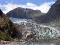
Fox Glacier, west coast of South Island
Outlet from Fox Glacier
Franz Joseph Glacier, west coast of South Island
Abel Tasman track, north coast of South Island
Abel Tasman track
Abel Tasman track
Abel Tasman track
Abel Tasman track nasty descent to remote beach
Abel Tasman track
Abel Tasman track
Abel Tasman track
Abel Tasman track
Abel Tasman track
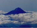
Taranaki from the air
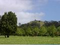
Lone Tree Hill, Cornwall Park, Auckland
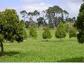
Cornwall Park
Cornwall Park
Australian fig tree, Cornwall Park

Lynda's niece Becky and beau James
Our cottage on Lynda's sister's house
Lynda's sister Hilary's house